
Eastern end of Boundary Road
Photograph taken 2002-07-04
| A Walk Around Taplow | Home | Large map |
|
|
Eastern end of Boundary Road
Photograph taken 2002-07-04 |
Slope down to area of rough grass. Trees and club-huts in the distance. Playing field on right. Pile of rubbish left by encampment of travellers.

|

|

|

|

|

All
images are © Andrew Findlay 2002-2007 and licensed under a
Creative Commons Attribution-Share Alike 3.0 License.
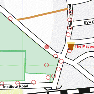
 Maps are derived from OpenStreetMap
data, licenced under the Creative Commons
Attribution Share-Alike 2.0 licence.
Maps are derived from OpenStreetMap
data, licenced under the Creative Commons
Attribution Share-Alike 2.0 licence.