
Footpath between gas holder and new bridge
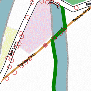
Photograph taken 2002-05-07
| A Walk Around Taplow | Home | Large map |
|
|
Footpath between gas holder and new bridge
Photograph taken 2002-05-07 |
Scrubby field, with earth bank of new flood relief channel beyond. Trees and bushes.

|

|

|

|

All
images are © Andrew Findlay 2002-2007 and licensed under a
Creative Commons Attribution-Share Alike 3.0 License.
 Maps are derived from OpenStreetMap
data, licenced under the Creative Commons
Attribution Share-Alike 2.0 licence.
Maps are derived from OpenStreetMap
data, licenced under the Creative Commons
Attribution Share-Alike 2.0 licence.