
At the western end of Approach Road
Photograph taken 2002-09-24
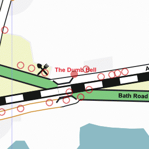
| A Walk Around Taplow | Home | Large map |
|
|
At the western end of Approach Road
Photograph taken 2002-09-24 |
Looking east on Approach Road. Wire fence and open fields on left. Group of houses set among trees. Railway embankment on right with large trees.

|

|

|

|

All
images are © Andrew Findlay 2002-2007 and licensed under a
Creative Commons Attribution-Share Alike 3.0 License.
 Maps are derived from OpenStreetMap
data, licenced under the Creative Commons
Attribution Share-Alike 2.0 licence.
Maps are derived from OpenStreetMap
data, licenced under the Creative Commons
Attribution Share-Alike 2.0 licence.