Photograph img_2803.jpg

On the pedestrian bridge across the Jubilee River next to the A4


Map of location 250 Location 124 Location 125 Location 126 Location 152 Location 153 Location 154 Location 155 Location 245 Location 246 Location 247 Location 248 Location 249 Location 250 Location 251 Location 252 Location 253 Location 294 Location 296 Location 297 Location 298 Location 299 Location 307

Photograph taken 2002-09-05
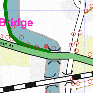
Looking south towards the A4 road bridge with the mainline rail bridge in the background. Metal railings in foreground. Road bridge has brick sides: mainly dark red brick, with darker capstones and base row. Two arches of the rail bridge are just visible above the parapet of the road bridge. Trees on horizon.

Pedestrian bridge across Jubilee River.
Galvanised metal railings on each side.
Wooden slat fence on left of path beyond bridge, with trees behind.
Traffic and traffic lights on A4 in the background. Looking south towards the A4 road bridge with the mainline rail bridge in the background.
Metal railings in foreground.
Road bridge has brick sides: mainly dark red brick, with darker capstones and base row.
Two arches of the rail bridge are just visible above the parapet of the road bridge.
Trees on horizon. Jubilee River (Maidenhead, Windsor and Eton Flood Alleviation Scheme).
The river runs between brick walls in the foreground, opening out to graded banks in the distance. Walls are of dark red brick with purple-gray capstones.
Galvanised metal railings along pedestrian bridge in lower-left corner.
Large trees each side of river.
Hotel building visible in the distance. River in foreground.
Sloping river bank with brick wall on right.
Trees with open field beyond and more trees on the horizon.


Creative Commons License
All images are © Andrew Findlay 2002-2007 and licensed under a Creative Commons Attribution-Share Alike 3.0 License.

Some Rights Reserved Maps are derived from OpenStreetMap data, licenced under the Creative Commons Attribution Share-Alike 2.0 licence.