
Footpath behind Buffins
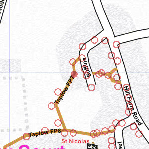
Photograph taken 2002-04-21
| A Walk Around Taplow | Home | Large map |
|
|
Footpath behind Buffins
Photograph taken 2002-04-21 |
Footpath with chainlink fence on the left, brick wall and house on the right. Field on the left used to be Taplow Vineyard, but now has grass and young trees.

|

|

All
images are © Andrew Findlay 2002-2007 and licensed under a
Creative Commons Attribution-Share Alike 3.0 License.
 Maps are derived from OpenStreetMap
data, licenced under the Creative Commons
Attribution Share-Alike 2.0 licence.
Maps are derived from OpenStreetMap
data, licenced under the Creative Commons
Attribution Share-Alike 2.0 licence.